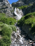
Bridal Veil Falls (click to enlarge) |
I frequently ride the Provo River bike trail. It's just a few minutes from my home and offers a great ride through some spectacular scenery. Over the last few years, I've taken pictures of the trail and the scenery surrounding it.
A few weeks ago, I wrote about a project one of my students is doing called ActiveTrails at Between the Lines. ActiveTrails let's users submit GPS data for trails they hike. Other users can comment on the trail. Each trail is shown on Google Maps and has elevation data. What's more, there's a USGS topo map service built right in. Here's the Provo River Trail displayed on ActiveTrails.
The Provo River trail is, like many great bike paths, built on abandoned rail bed for the line that used to connect Provo to Heber City. The trail ends at Vivian park because the rail beds active from there to Heber. That's a little odd, but there's a historic railroad that runs as a tourist attraction between Heber and the park called the Heber Creeper. I don't think there's any chance that rail line will be abandoned for a good while, but I really wish the bike path went all the way to Heber--that would be a great ride.


